
Calhoun County Property Value Types
Three numbers get confused constantly. Assessed value drives the tax system, while market or appraised value is a full-value estimate. Sale consideration is simply the amount attached to a recorded transaction. The Assessor notes that property in Calhoun County is generally assessed at 60 percent of market or appraised value. A deed's consideration is a fact about the past, not a current quote. Always read the source and date beside each figure.
| Value | What It Is | Where |
|---|---|---|
| Assessed value | Tax value, generally set at 60 percent of market or appraised value | County Assessor |
| Market or appraised value | Full-value estimate used in the assessment process | Assessor methodology or a separate appraisal |
| Sale consideration | Amount reported in a deed when recorded, if shown | County Clerk instrument |
| Land and improvements | Separate components of an assessment, if the card displays them | Assessor card; result fields need live verification |
The county publishes no sales-ratio report or neighborhood trend online. Treat the assessment as a tax figure, and use the underlying record date to understand what it represents.
Calhoun County's 60 Percent Assessment
The Calhoun Assessor's general information page states that assessed value is generally 60 percent of market value. That figure can also be called appraised value. That gap explains why the tax number often sits below a recent sale amount. It does not mean a parcel will sell for a simple multiple of its assessment. Land condition, improvements, use, exemptions, and the assessment date all shape the figure. The office runs an annual sales-ratio analysis. It also prepares a list of real-property transfers from the prior assessment year by December 1. No Calhoun County ratio report appears online. A researcher who needs a defensible explanation can ask the Assessor for the applicable analysis. They can also ask for the applicable transfer entry rather than calling the online number an appraisal.
How to Find a Calhoun County Value
The Assessor's search accepts Owner Name, Parcel Address, Account number, District, Map/Parcel, Property Type, Legal Description, and Deed Book/Page. Use an account or map key if an address is uncertain. Exact land and improvement fields, sale date, and coverage year should be checked on the live record itself.
- Search the Assessor by address or owner and select the matching property card.
- Write down the account, District/Map/Parcel, class, legal description, and value fields shown.
- Compare the assessment date and tax year with the newest recorded deed.
- Ask the Assessor for its transfer or sales-ratio information when the basis for a value is unclear.
The Calhoun County Assessor Property Record Search page displays the portal inputs used to reach a card. It is a search form, not a sample valuation.
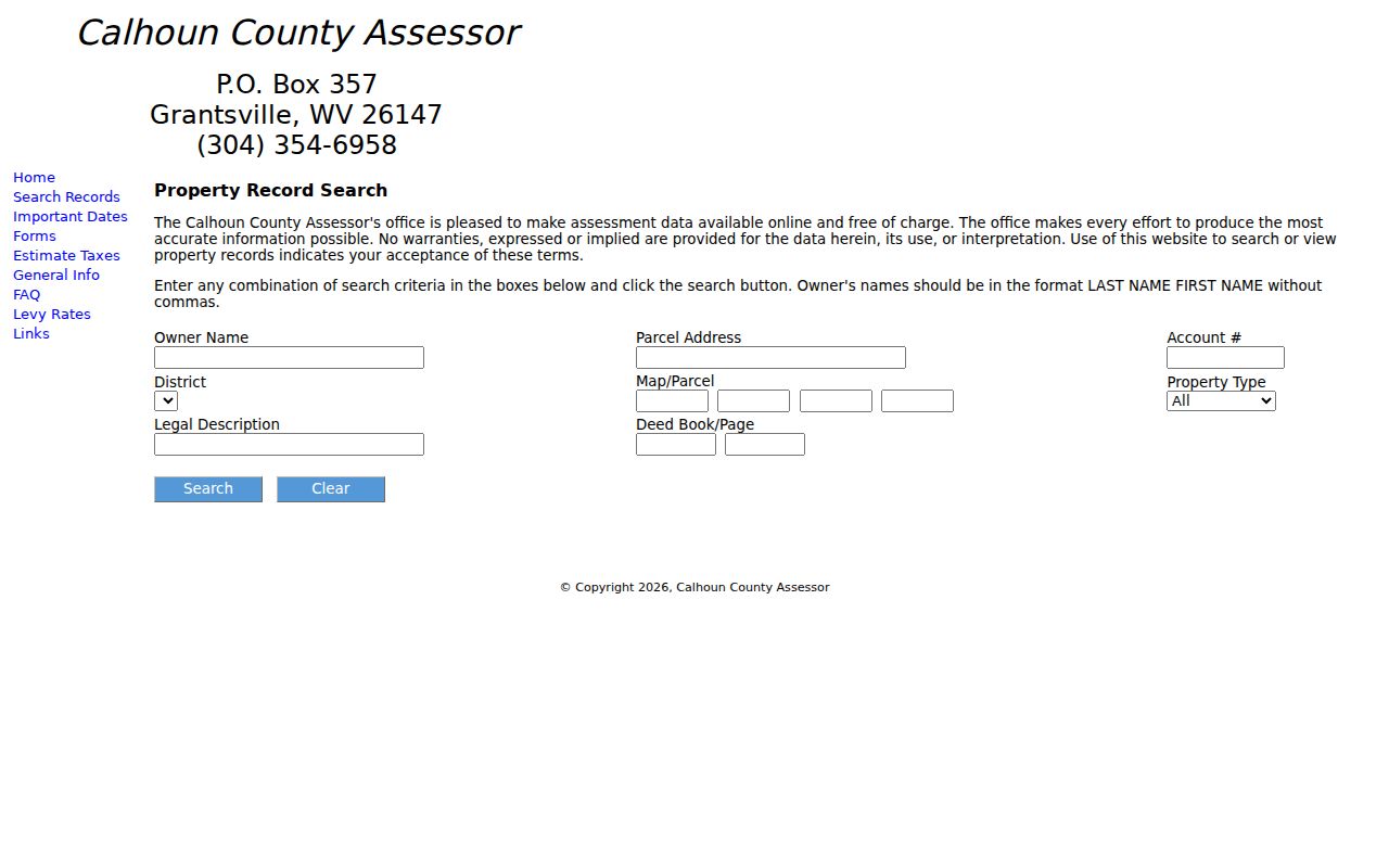
Use the form to reach the correct record. Then read its date and value labels before comparing amounts.
Calhoun County's July 1 Value Date
The assessment date is July 1. Calendar-year tax books use ownership, taxability, condition, and use as of the prior July 1. The Assessor completes land and personal-property books by January 30. Those books go to the Board of Review and Equalization by February 1. Assessed values are certified by March 3. A sale after the July snapshot may not appear in the roll behind the next bill. The office assesses property annually. The statewide viewer refreshes its information yearly. It names no single Calhoun County revaluation year or fixed date when each card changes. Compare a transfer date with the tax-year basis before treating any value as current.
Calhoun Class and Use Effects
Classification can change how a value is treated. Class II covers owner-occupied residential and farm property. Class III covers other taxable real and personal property outside an incorporated municipality. Class IV covers other taxable property inside one. Calhoun County has one incorporated town in the roster. The Grantsville boundary may affect class for otherwise similar parcels. Class does not prove that a named person lives there. A qualifying homestead or disability exemption reduces assessed homestead value by $20,000 under the Assessor's explanation. The application window runs July 1 to December 1. Eligibility is based on West Virginia residence plus age or disability. Farm-use valuation applies fair rental value. It can fall to one tenth or less of market value. These programs make an assessed figure unsuitable as a direct sale comparison. For bill amounts, exemption steps, and appeal procedure, use the separate Calhoun County property tax records page. This value page focuses on what the numbers mean and where each one is recorded.
Sale Consideration and Deed Dates
A recorded deed may show consideration tied to one particular transaction. The public index and Assessor card may or may not display a last-sale amount. Inspect the instrument rather than expecting a field on the search result. A transfer amount can reflect family conveyances or partial interests. It can also reflect estate distributions or other terms that differ from a full-market sale. Use the recorded date and parties alongside the legal description. A sale amount is not a current valuation. The assessment roll may rest on a prior July 1. Where the deed and the card differ, keep both figures with their source and date. Do not treat one as an error.
Calhoun GIS Acreage Is an Estimate
The statewide assessment viewer separates two numbers. Deeded acreage comes from the legal description itself. Calculated acreage is just a GIS estimate drawn from mapped geometry. The map is a best-fit tax reference. So the state viewer warns that parcel lines are not conclusive proof of ownership. A calculated area may run larger or smaller. That does nothing to the deeded land rights on its own.
Looking Up a Calhoun County Property Value
Start with the Calhoun County Assessor's free Property Record Search. Enter a parcel address or owner name. You can also use the account number and District/Map-Parcel when available. Owner names go in LAST NAME FIRST NAME order, with no comma. Property Type, Legal Description, and Deed Book/Page offer other ways to narrow the results. The form locates a record. Confirm the result-card fields live, since no sample parcel is displayed.
- Search the address, owner, account, or District and Map/Parcel in the Assessor's online form.
- Record the account and legal description so the card can be matched to the right tract.
- Read the value labels and the applicable assessment year shown; ask the Assessor if the live card does not display a field you need.
- Compare the assessment date with the July 1 basis and review the deed separately for any recorded consideration.
- Assessed value
- The value used in the tax roll; Calhoun generally assesses at 60 percent of market or appraised value.
- Market / appraised value
- A full-value estimate used in the assessment process, not a guaranteed sale price.
- Level of assessment
- The relationship between assessed value and market value; no public Calhoun sales-ratio report was located.
If an online result shows no value or valuation date, call the Assessor at 304-354-6958 or write to P.O. Box 357, Grantsville, WV 26147. Ask for the tax year and the valuation basis tied to that parcel. The office performs annual sales-ratio analysis and posts a prior-year real-property transfer list by December 1. Request the source record rather than inferring a neighborhood trend from one card.
What a Calhoun County Assessor Value Is Not
An Assessor's value exists for taxation under countywide assessment rules. It is not a licensed appraisal. It will not tell you what one property would sell for today. No official sales-ratio report backs a Grantsville or Calhoun neighborhood price trend, either. For a market decision, rely on a qualified valuation professional. Weigh the relevant transaction, condition, and date.
Value vs price. A Calhoun County assessed value is a tax figure, not a promise of sale price. Use a licensed appraiser for a market valuation.